Getting really jealous of the girl who went out West - tar sands madness and all. All Sarah's talk of maps and this new initiative of
Missing Justice involving land names and mapping . . . I have been interested in maps for ever as far as I remember - these ways of envisioning land, so strange, so abstract. yet fascinating. At some point I copied from my map of the world nothing but the rivers and printed these onto different pieces of fabric I dyed or found lying around. At the same time I copied nothing but the borders. Such different relationships to land. I think our worldview is wildly affected by political maps, where chunks of land are yellow and others pink to tell between them. How does this speak to the land, the water, the geography that sustains our lives? It speaks to nations and separations and borders between people - cultures are already diverse within and without the borders. So it really is definitive of this concept of nation. Which at the same time has everything and nothing to do with land.
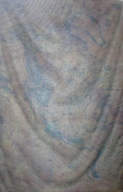
Anyway. This piece is a geographical map of north america printed on a doubly dyed piece of cotton. It was in a Study in Action conference that QPIRG Concordia put on this spring, though it is a bit difficult to view due to the draping of the fabric...

KATIE EARLE - WHOSE WATER IS IT ANYWAY?
"Emphasizing the waterlines on a geographical map of the continent, this piece references Indigenous rights to clean water, and questions the validity of Canada's "ownership" - and thus ability to sell - this natural resource. Most of Canada's water rights have already been 'bought' by the USA, relinquishing Indigenous rights to the water of their land. Meanwhile the Athabasca river is becoming daily more contaminated by Alberta's disastrous Tar Sands megaproject."